
Over Veteran's Day (Nov 2021), Rui, Tom, and I did a quick three-night/four-day hike in the Grand Canyon, going down New Hance Trail on Nov 11 and coming out on Grandview Trail on Nov 14. This is one of my favorite South Rim hikes, for several reasons. First, New Hance is a challenging trail (one of the most difficult on the South Rim), so it doesn't get a lot traffic, which makes for plenty of solitude and a wonderful backcountry experience; the lack of crowds also makes it easier to get permits. Second, it's relatively short---it can be done as a two-night backpacking trip---which makes scheduling easier. Finally, it's geologically fascinating: at one end, Red Canyon (which New Hance goes down) cuts through the colorful layers of the Supergroup, the bright orange-red of the Hakatai Shale among the most conspicuous of them; then, as one treks west along the Tonto, the rock layers gradually rise up and by the time one reaches Hance Canyon a few miles away the crazy chaotic mess of the black Vishnu Schist basement layer is on full display; at the other end, going up Grandview Trail, the ground is strewn with green-flecked rock shards from copper minerals that formed the basis of mines in this area a century ago. In a landscape where gorgeous is routine, this hike stands out as stunning.
I stayed in Tom's cabin near Valle the evening before the hike. We drove up towards GCNP's South Entrance in the pre-dawn darkness to get Rui and head for the trailhead; the six miles separating the endpoints of our hike, and the resulting need to leave a vehicle at each end, made this slightly more involved than otherwise. The sky was just beginning to lighten at this point, the landscape gradually resolving into shades of light and dark gray, and twice I had to hit the brake hard to avoid running into elk claiming ownership of the road. But mishaps were averted, and after a minor detour from initially missing the unmarked spot leading to New Hance trailhead, we put our packs on and headed down. It was around 7:30 AM, and the sun was just beginning to be visible above the Canyon Rim.
Day 1. New Hance Trailhead to Hance Rapids
Once one starts down New Hance it quickly becomes clear why there are so few people on this trail. At 6.5 miles it's the shortest of all rim-to-river trails on the South Rim (and since the total elevation drop is roughly the same for all of them, therefore also the steepest). The trail drops steeply and relentlessly; the long slogs across interminable Supai traverses, so characteristic of other GC trails, are much abbreviated. The rock layers go by quickly.
 |
| Rui straightening his bent hiking pole |
We picked our way down the steep, loose, rocky trail carefully. Progress was slow. At one point Rui accidentally ran into his hiking poles and bent one of them; to my pleasant surprise, he was able to straighten it back, and they worked out fine for the rest of the hike.
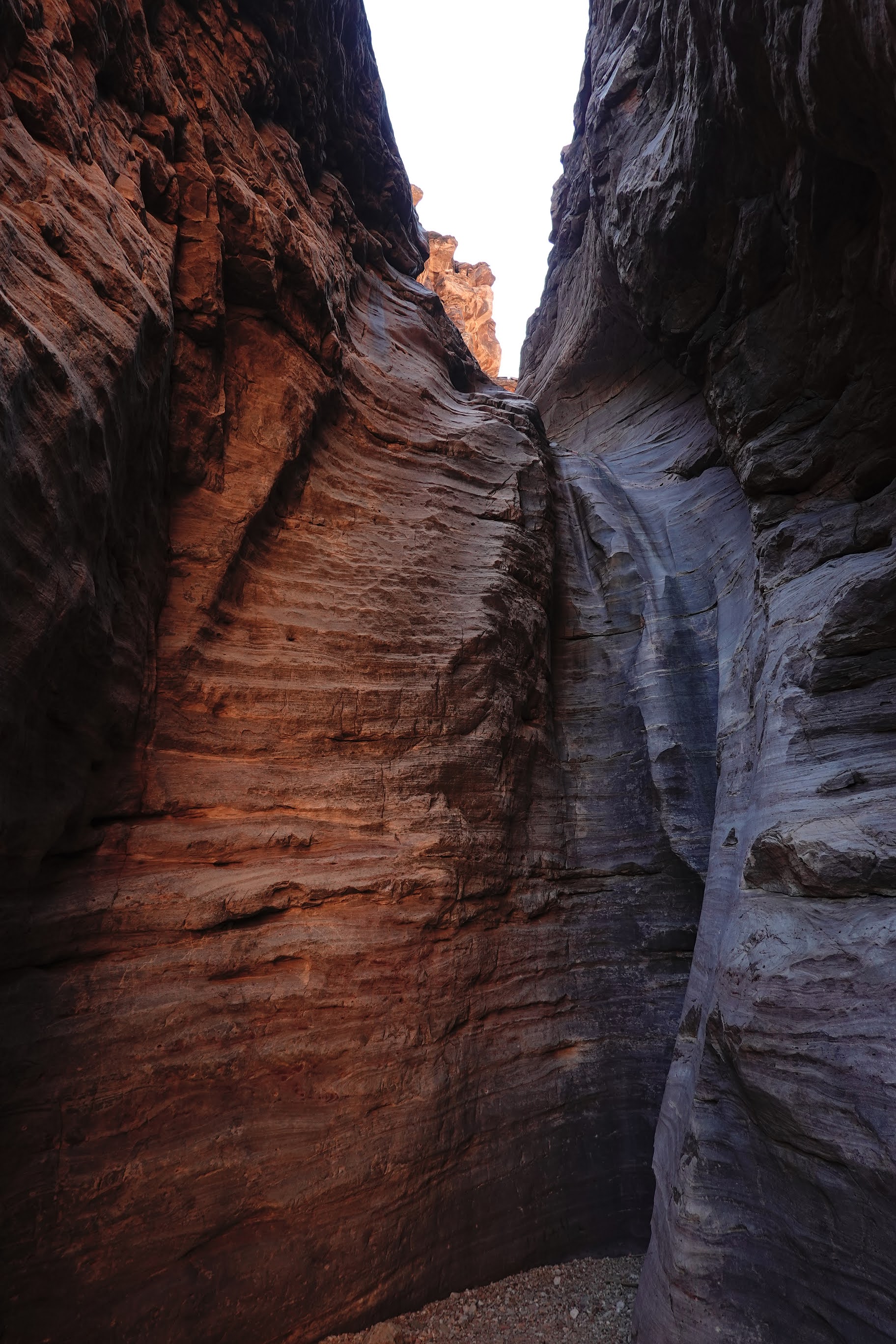
 |
| Crossing a rock slide |
The trail seemed harder than it had been a couple of years ago. It looked like the trail had suffered from an unusually wet monsoon season. Rock slides had buried the trail in a number of places, needing us to boulder-hop carefully across them, hoping that a stable-looking rock wouldn't suddenly shift underfoot. The trail had washed away at other places, leaving gaps to be stepped across gingerly. There was more exposure than I remembered.
 |
| Redwall Cliffs |
We were at the top of the Redwall by around noon-ish, stopped briefly for lunch at one of the campsites below the Redwall, and were down by the floor of Red Canyon a little after 2pm. There was a thin trickle of water flowing---enough to be reassuring, but not enough for a convenient overnight camp. Tom was feeling tired at this point (and I'll admit the relentless downhill had left my quads and calves achy as well), so Rui and I went ahead while Tom followed more slowly. We reached the Colorado around 3:30pm, scouted around for a bit, and were in the process of setting up camp when Tom showed up. We sat around and relaxed for a bit, finished our camp setup chores, and had an early dinner.
It got dark soon after the sun set around 5:30. I was tired and fled into my tent by 6:30. There was about a half-moon out, which seemed pretty bright in the darkness of the Canyon, but I was tired from the day's hike. With the soothing background roar of Hance Rapids drowning out all other sounds, I don't think I was awake very long.
The evening had been delightfully pleasant, and I had decided to leave my rain fly off overnight. When I woke up some time during the night, after moonset, the sky above me was an ocean of glittering jewels: the Big Dipper rotating into view above the cliffs just across the river from us; the familiar W of Cassiopeia astride the Milky Way above me; and Orion standing guard further south. I don't think I will ever get tired of this treat.
Day 2: Day hike to Papago Canyon

|

|

|
| The cliffs above Hance Rapids in morning sunlight |
This was a rest day, and there was no pressing need to be up and about early. After a leisurely breakfast we moved our camp to a shadier spot closer to water. Tom decided to stay behind at camp, so Rui and I headed out east for a day hike along the Escalante Route, which Tom and I had hiked a year earlier.
We soon came to the Papago Slide, this time approaching it from the west. Going up the Slide seemed easier than coming down; it helped that I had come down the Slide a year ago and so had appropriately lowered expectations. I went up first, and Rui came after me once I hollered down that I was clear. He zipped up so quickly that I didn't have time to get a picture of him coming up!

|

|
| Papago Slide |
We reached Papago Canyon maybe ten or fifteen minutes after coming up Papago Slide. I had last been here heading east-to-west on the Escalante Route, and things looked quite different coming in the other direction. We stood confusedly for a while at the top of Papago Canyon, staring at the map on my phone, my mind refusing to accept that the trail lay below what seemed to be a vertical cliff in front of us. Once we finally figured out where we needed to be, and scrambled down the short distance to the top of Papago Wall, I found myself singularly unenthused about climbing down the short cliff face. Eventually, after much hemming and hawing, I went down and Rui came down after me. As on the previous trip, the issue was more mental than physical, and once I began the downclimb it went quickly and uneventfully. Rui and I had lunch by the river. We had the place entirely to ourselves (in fact, we hadn't seen a single person since we left camp that morning), and it was quite lovely.

|

|
| On the way to Papago Canyon |
Papago Canyon looked like a pretty cool slot canyon, and after lunch we thought we might try to hike up the canyon for a bit. Unfortunately we weren't able to find a plausible way down into the canyon where we could also be confident about our ability to get back out afterwards. Eventually we gave up and headed back towards camp.

|

|
| Papago Canyon |
While we were on top of the cliff above Papago Wall, we spotted two small inflatable rafts going down the river. Afterwards, we found out from Tom that they were both Park Rangers, one of them someone we had met when hiking Boucher with the Johannesmeyers in 2020.
When we got back to camp, we found that Tom had hurt his back and movement---even routine movement, like standing up or sitting down---was uncomfortable. This was a bummer.
The rest of the day was pleasant and uneventful. I was in my tent before 7pm.
 |
| Approaching dusk: cliffs at Hance Rapids |
Day 3. Hance Rapids to Hance Creek
A mellow day of hiking: 6.5 miles, with an elevation gain of about 1100' climbing from Hance Rapids to the Tonto, almost all of which happens in the first mile or so out of Hance Rapids, which means that most of the remaining 5.5 miles is "Tonto flat"---mostly contouring along, with occasional ups and downs but nothing really big. We got on the trail a little after 8 AM. The weather was perfect, with a blue sunny sky and pleasantly warm temperatures. The hike to Hance Creek was delightful, and we had the campsite entirely to ourselves. The only people we saw through the entire day were: a group what looked like a bunch of Boy Scouts and two trail runners who breezed through Hance Creek as we were setting up camp.
Day 4: Hance Creek to Grandview Point
 |
| Taking down camp |
The last day of our hike: 5 miles to the rim at Grandview Point, with an elevation change of 3700'. We were up by 5:30 and hiking by 7:30. The trail stayed flat over the short half-mile stretch of Tonto from Hance Creek to the junction with Hance Creek Trail, then began climbing, growing steadily steeper and rougher as we got higher. As with the descent on New Hance (though nowhere as bad), the trail seemed more difficult than I remembered it from my last visit, possibly due to the effects of a very wet monsoon season: at several places, mostly while going through the Redwall, we had to climb over rock slides or step across washed out sections.

The ascent through the Redwall layer is a steep hard loose rocky slog on every Grand Canyon trail I've hiked; the reward at the end is often simply the relief that the relentless uphill will be replaced, at least for a while, by a kinder-on-the-lungs traverse through the Supai. The Redwall section of Grandview is just as steep a slog as the others, but comes with a unique treat: as one approaches the top, the ground is increasingly strewn with bright green and blue flecks of copper ore. I expect a lot of these brightly colored rocks have disappeared over the years, but what is left is still beautiful.

|

|
| Remnants of the Last Chance Mine |
We took a break for lunch at the top of Horseshoe Mesa, sitting in the shade of some junipers and enjoying the cloudless blue sky, the sunlit cliffs in the distance, the quiet and solitude. The ground around us was littered with shards of broken glass and ceramic plates, and a few yards away the remains of an old iron bedframe lay rusting in the sun: artifacts left over from a time when mining was active, now considered historical and protected.
After a while we reluctantly put our packs back on and headed uphill. The trail climbed steadily, we huffed and puffed our way up switchback after switchback, and the sun slowly slid across the sky. The last several hundred vertical feet, through the upper rock layers, were slow going. We reached the top some time around 3:30.


No comments:
Post a Comment