
Preparing for the Hike
What made preparing or this trip different was the remoteness and inaccessibility of the areas we planned to be at. This made resupply impractical, which in turn meant we had to take with us everything we'd need over the duration of our trip. For me, this meant the following:
- I make and dehydrate my own backpacking meals, which, to increase calorie density, have high fat content. I didn't know whether this high-fat food would keep for the duration of a three-week hike. So I left a bag of the stuff sitting in a corner of the kitchen, and I'd open the bag each week and smell to see whether it had gone rancid. To my relief, it was still fine at the end of a couple of months.
- While it would be technically possible to go three weeks in one set of clothes without washing them, I worried about the effect on others around me. This meant I needed a light and convenient way to do laundry. I ended up taking a couple of two-gallon ziploc bags that I could use to wash my clothes. This worked out pretty well.
- Possibly the weirdest part of the planning process was figuring out how much toilet paper to take. For a typical hike of a week or less, I'm comfortable with eyeballing an estimate; for something thrice that length I wasn't quite so confident, and the last thing I wanted was to discover, deep inside the Grand Canyon, that I had mis-estimated. So for a couple of weeks before the hike I wound up working on a spreadsheet that monitored my daily TP usage. (To decide how much to actually take, I used a 2x multiplier to the average number of TP squares per day.)
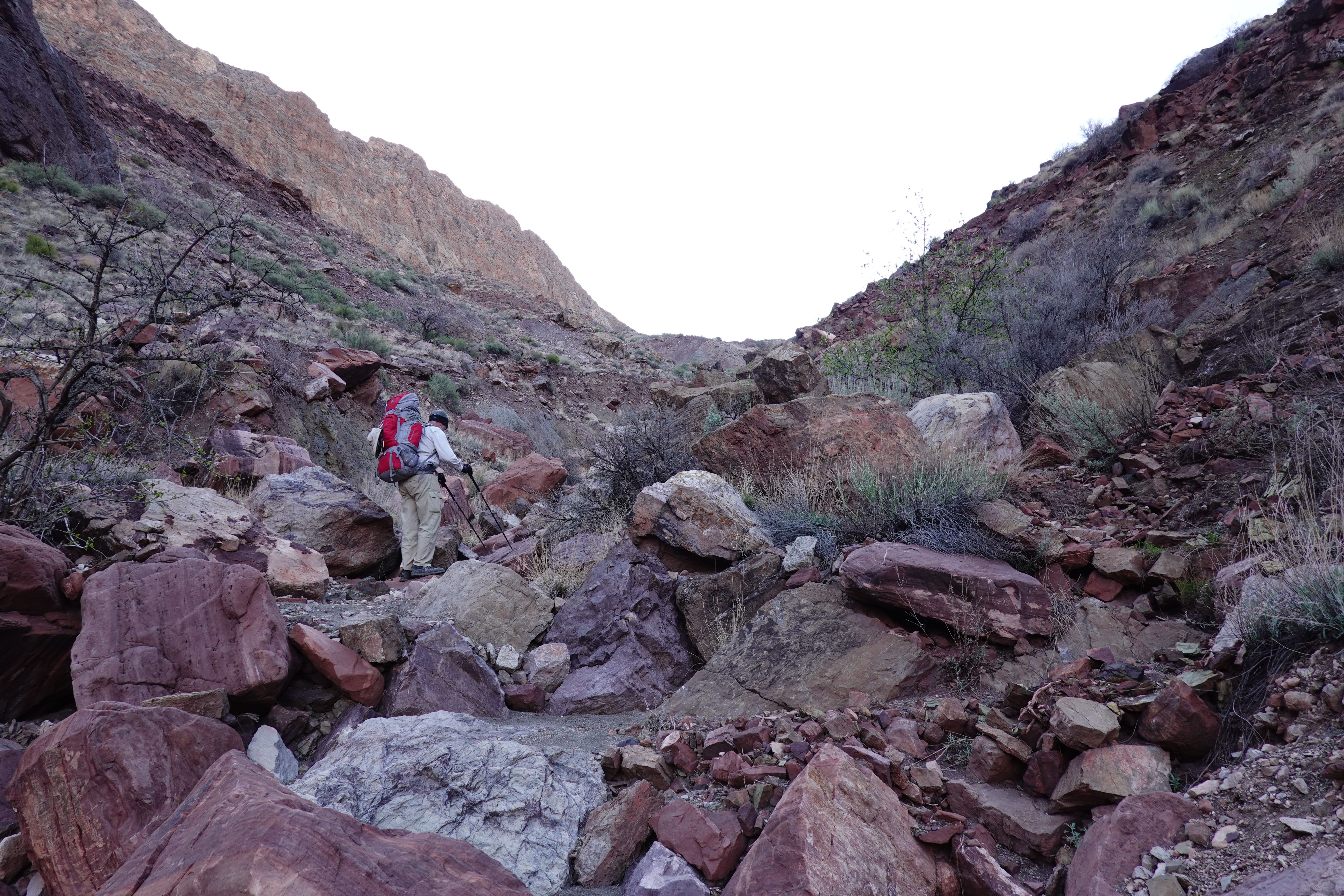
Days 0-4: Trailhead to Nankoweap Creek
 |
| View from the trailhead |
 |
| Camp below Saddle Mountain |
It was cold the next morning, and leaving the warmth of my sleeping bag was an effort. We were on the trail a little before 8. As we hiked up towards the canyon rim, there was more and more snow covering the ground. The accumulation from last week's storm had formed a hard crust that was easy to hike on but which we occasionally broke through; last night's snow looked like bleached white gravel strewn carelessly atop this.
 |
| Snowy trail near Marion Point |
I was resigned to a tough downhill hike the next day, and the Canyon did not disappoint. Moves that had seemed straightforward on prior trips, such as a tree-assisted downclimb a little above Tilted Mesa, became much harder with a heavy and bulky pack tugging in unexpected directions at unexpected (and, usually, inopportune) times. But we made steady progress and reached Nankoweap Creek around 11.

|
||||
|
||||
|
||||
| Views from Nankoweap Trail |


We had two full days at Nankoweap, and weren't in any big rush to get anywhere, so they were slow and relaxed. We walked upstream for a while the first day, but didn't get very far: we came to a place where the creek bed was paved with huge big flat stones, and sat down and spent the rest of the afternoon enjoying the warmth of the weak sunshine. The next day we headed downstream towards the Colorado, but instead of turning south towards the granaries, which we had visited several times on prior trips, we headed north towards Little Nankoweap Creek. The river comes around a wide bend at this place and the current is slow and gentle, making for a still surface that creates a beautiful reflection of the cliffs on either bank. We found a nice flat shady area (possibly used as a campsite by river runners) and spent much of the rest of the day enjoying the view.

|

|

|
|

|

|
| Nankoweap Canyon | |
A storm was supposed to blow in that evening. In preparing for that the previous night, I was trying to move a big rock near my tent and felt something go pop! in my right knee. After the initial jolt it was only a little sore and didn't seem to impede movement, so I didn't think too much of it at the time. But I would be reminded of this, not in a good way, many times over the rest of the hike. In the end, the promised storm didn't amount to much more than a lot of wind and some sporadic spits of drizzle.
Days 5-7: Kwagunt Canyon
We broke camp early the next morning and headed up the Butte Fault towards Kwagunt Canyon. The route goes up a gully slightly upstream from our campsite to a saddle between the two canyons, and then down into Kwagunt. There is no trail here (though occasionally we'd come across stretches where enough people had walked to create a visible path), and both the uphill and the downhill stretches are hard work. First, hiking up the gully involves going over or around a lot of big boulders and makes for slow progress. Then there's a stretch of boulder-hopping across the deposits from some long-ago rock slide. Then working our way up a steep slope of loose scree. Then more boulder fields. Then edging our way carefully across a steep hillside that is basically one huge slab of rock. And finally, a long exposed traverse across a loose scree slope—not terribly difficult, but with a long dropoff on the downhill side that could mess with one's mind.
|
||
|
||

|
||
| The hike to Kwagunt Canyon: Climbing out of Nankoweap | ||


On the way up from Nankoweap we saw several different kinds of wildflowers dotting the hillsides: tiny little flowers, white and pink and purple, on tiny little plants hugging the ground. Plant sex can't afford to be flamboyant in this arid landscape. And yet, even just the act of blossoming in this stark desert seems like an incredible statement of hope and optimism.
|
||
|
||
|
||
| The hike to Kwagunt Canyon: Descending into Kwagunt | ||


We reached the campsite at Kwagunt Creek around 1 PM. It was a tiny little patch of ground, surrounded by gullies full of boulders and thorn trees, with the creek to one side. The soil was soft and dusty: easy to push tent stakes into, but every little movement stirred up dust. A big boulder took up much of the space, leaving two little flat spots just barely large enough for a tent each and not a lot of room for much else; getting around each other, even for something simple, needed careful choreography.
There wasn't much point in setting up our tents right away to bake in the harsh sunlight, so we sat around in the shade of some scraggly trees for a while, then decided to explore a little nearby. We wandered upstream a short distance—and, on our way back, we couldn't find where we had left our packs! It took some wandering around before we located them. Later, when we were sitting at dinner, I suddenly heard a loud buzz by my head: a hummingbird had flown up to check out my bright magenta hat! It hovered around for a second and then flew off, leaving me wondering what it was doing in this place that was so utterly devoid of the sorts of flowers I associate with hummingbirds. I hoped it wouldn't go hungry.
That night was quite windy, and I was awakened several times by the wind howling down the canyon, shaking the tent as it rushed by. In the morning, everything inside the tent was covered in a fine red-brown dust.
 |
| Armor-plated hillside |

|

|

|
|
| Kwagunt Canyon | |
One interesting feature of the creek was that the minerals in the water bound to the mud and stones in the creek bed as it dried, forming long hard concrete-like channels. In some places, this hard conglomerate formed an overhang above the flow of water.
Back at camp, everything was dusty. There was a fine layer of reddish sand on everything in the tent. My shirt had red streaks of dust; my pants were dirt-blotched; when I picked up my Nalgene bottle its sides were coated with dust. It was windy again that night, and every gust of wind blew dust into the tent: tendrils of smoke in the light of my headlamp. Much later, a little before midnight, I awakened to the sound of a pair of great horned owls hooting back and forth not far from camp. When I went outside, there was no moon out, and the stars blazed overhead in the dark sky. It was a glorious show.
We spent our last day hiking up to the saddle with Malgosa Canyon in order to scout out possible routes for the next day's hike. Even with just a day pack, it was quite a workout: on the map, it's only a mile or so from our campsite to the saddle, with an elevation change of about 1400 feet, but the terrain was hard: first a boulder- and brush-clogged gully, then up a steep hillside; then a traverse across a steep slope covered with loose rocks and precariously-perched boulders; then a hand-and-foot scramble up a loose steep slope. It took us three hours of huffing and puffing to cover that mile. Once at the saddle we sat and enjoyed the vista around us. The hike back down was slow as well, needing a lot of care due to steep slopes, loose rocks and boulders, and iffy footing.
 |
| Nankoweap Mesa |
Day 8: Kwagunt Canyon to Awatubi Canyon
The itinerary for the day was to climb out of Kwagunt Canyon down into Malgosa Canyon and then over and down into Awatubi Canyon.
 |
| The route out of Kwagunt Canyon |
Scary moments: At one point I was standing on a large boulder, waiting for Tom to reach a stable position ahead of me, when suddenly I noticed a small avalanche of dirt and gravel below my rock. I got off that boulder in a hurry. A little later, as we were scrambling up the hillside, I grabbed a big handhold to brace myself up a steep section, and it wobbled as soon as I put weight on it, necessitating a hurried search for something else to hang on to.

|

|

|
|
| The hike out of Kwagunt Canyon | |
The hike into and out of Malgosa Canyon was easier than Kwagunt, but still hard work. Steep slopes covered with ball-bearing-like loose rocks needed care going down. The hike out started up a dry streambed with lots of boulders and sharp-pointed agaves to work around. Closer to the top there was a long section of contouring across a steep slope full of loose rocks that made keeping one's footing difficult and ended up needing a fair amount of hand-and-foot scrambling. The descent into Awatubi Canyon seemed a lot simpler by comparison: just a long descent down the side of the canyon, with the by-now-usual steep loose rocky slopes, the distinctive shape of Awatubi Crest dominating the skyline above us. It was mid-afternoon by now and quite warm, and I was getting tired and was slowing down, so it took me a while to get to the bottom of the canyon. Tom saw a small isolated trickle of water at one place, but the creek was dry elsewhere. Since there weren't any other plausible campsites that we could see, and the creek bed was wide and level, we pitched our tents there.

|

|

|

|
| Top row: Malgosa Canyon. Bottom row: Awatubi Canyon | |
We didn't see very many birds or other wildlife today. But on the hike out of Malgosa Canyon we were buzzed twice by hummingbirds, and around dusk a sphinx moth came and hovered for a few moments, checking us out. But there were no flowers that we could see, at least in Awatubi Canyon—just thorn scrub and juniper trees. What could they possibly be living on?
Day 9: Awatubi Canyon to Lava Canyon
Awatubi was a dry camp and we had brought water for just the one night, so the next morning it was time to move on to someplace that had water. Our planned itinerary involved hiking into and out of several drainages: from Awatubi to Sixtymile to Carbon to Lava Canyon, which had a perennial stream. Each descent began down the steep upper slopes of the canyon, slippery with loose rocks and rubble, eventually leading down into the bottom of a gully choked with brush and boulders; each ascent was a similar slog in reverse. Progress was slow and tiring: we started from Awatubi Canyon at 7 AM and reached Lava Creek around 6 PM; according to my GPS tracker, we covered 7.4 miles (11.8 km) in those eleven hours at an average speed of 0.7 mph, with a total elevation gain of about 5,900' (1,800 m) and total elevation loss of about 6,900' (2,100 m).
 |
| Awatubi Crest |

|

|

|

|
| Sixtymile Canyon | |
The hike to the saddle between Sixtymile and Carbon Canyons was the by-now-routine bushwhack up a brush-and-boulder-choked gully. The descent into the East Fork of Carbon Creek was quite steep at the top, and once we dropped into the gully there was a lot of hand-and-foot scrambling down big drops and boulder piles. The terrain became easier about a third of the way down: the canyon widened and the canyon bottom became more level and sandy-bottomed. In many places the canyon walls were steeply tilted rock layers in beautiful colors ranging from dark reds to vivid blues and greens. To my surprise (considering that we had had a dry La Niña winter), there was water in a stretch the East Fork of Carbon Creek about halfway down the canyon: oily-sheened unappetizing-looking water in some places, moist sandy soil at others.

|

|

|
| Carbon Canyon | ||
In addition to the rough terrain and heavy packs, it was quite warm, especially in the afternoon sun. Tom ran out of water coming down Carbon Canyon; my water ran dry not long after. Although we were just a mile or so of relatively easy hiking from our destination at Lava Creek by that point, the heat, fatigue, and thirst made that last stretch of the hike especially trying. We were glad to take off our packs by Lava Creek.
Days 10-13: Lava Canyon I
 |
| Tom doing laundry in a ziploc bag |

|

|
|
| The hike up Lava Canyon | ||
The creek was full of life. Large black and yellow butterflies flitted about aimlessly. Frogs panicked by our approach hurled themselves off the rocks where they had been sunbathing. There were a lot of spiders, about the size of quarters, crouching on rocks along the creek, the females with egg sacs on their abdomens. The spiders seemed to be keeping an eye on us as we approached—one had gotten into my tent last night. I had recently read Adrian Tchaikovsky's award-winning sci-fi novel Children of Time, and curious-seeming spiders made me uneasy.

 |
| Rainclouds over Lava Canyon |
Day 14: Trying for Unkar
 |
| Hiking up towards Unkar: view looking into Lava Canyon |
The ravine leading up to the Unkar crossover had the by-now-familiar challenges: piles of boulders to work around or over and thick brush to work through; what made it harder than much of the hike so far was its steepness, together with the fact that the brush and boulders got worse as we climbed higher and the soil became looser and crumblier.
.png)
Scary moments: The steep and loose terrain meant that, despite our best efforts, the person higher up would sometimes dislodge rocks—some quite large—that then rolled down towards the person below. More than once our huffing and puffing would be interrupted by a cry of "Rock!" and the person below frantically dodging or ducking to avoid getting hit. There were also a couple of occasions, during the "rock climbing" phase of the day's hike, when we were trying to figure out a way to get past the cliff at the very top, that got the blood moving. At one point I was balanced precariously on some small footholds above a significant drop. I was preparing to take a step forward, and needed handholds. There was a nice big rock on the wall in front of me, and I grabbed it ... and it began to come away from the wall. Oops, find a different hold, quickly! This sort of thing happened several times. Another time, I was climbing back down from one such excursion, standing on little toeholds but with reasonable fingerholds (three fingers of each hand). As I tried to move down to the next foothold, both my feet slipped and suddenly I was dangling by my fingertips above an unprotected drop of around 10 to 15 feet above a pile of rocks. Luckily Tom guided me to the next set of footholds, and I was able to stabilize myself and finish the downclimb.
It was late afternoon by that point. We didn't have enough daylight left to descend far enough to find a flat place where we could set up tents, and the terrain was too steep and loose to attempt a descent using our headlamps, so we had little choice but to spend the night up where we were. We squeezed ourselves into a bivy in a tiny spot, about as big as a modest-sized dinner table, wedged behind a boulder that would keep us from sliding down the slope overnight. Tom inflated his sleeping pad; I was concerned about puncturing mine on a sharp rock or stick, and opted to sleep with just my tent footprint below me. It was a cold and shivery night.
The next morning we spent a little more time exploring options to get to the top, but nothing worked—always there would be just a small section of cliff, maybe eight or ten feet high, that we couldn't get through. We were tantalizingly close to the top, within 150′ of it from the map, but to our great disappointment we weren't able to find a way to finish it. Eventually, tired and discouraged, we gave up and headed back down towards Lava Creek.
Days 15 and 16: Lava Canyon II
The hike back down to Lava Creek was harder than I had expected, maybe because I was tired from the previous day's exertions and hadn't had much sleep overnight. We were both pretty tired by the time we got back to our Lava Creek campsite. It took me a long time, moving in slow motion, to get my tent set up and a few basic chores done. But it felt wonderful to be able to sit down and rest, and by dinner time I felt a lot recovered.
The next day began inauspiciously. Our plan had been to take a rest day at camp and then hike down to the Colorado River the following day to try and get a ride across the river. But while setting up for breakfast I realized I was one day short on food (the permit said "20 nights below the rim"; I had focused on the number 20, overlooking the fact that 20 nights of camping meant 21 days of hiking). After some discussion, we decided to skip the rest day and hike down to the river to try and get a ride across.
We packed up hurriedly after breakfast and were on the trail by 9:30. As we were hiking down the creek, I slipped on a smooth rock and took a hard fall, wrenching my already-sore right knee painfully and bending one of my hiking poles. This was probably the low point of the day. Tom helped me straighten out the hiking pole somewhat, and a couple of ibuprofens helped quieten the knee. Soon we were ready to move again.

|

|

|
| The hike down Lava Canyon | ||


|

|

|
|
| The view from Lava Canyon Rapids | |
We reached the Colorado in the mid-afternoon, as luck would have it just minutes before a raft party came in. After hearing our story they agreed to give us a ride across the river, thus solving our most pressing problem. That put us within a two- or three-day hike to the rim, solving the food problem as well. A little while later, one of the rafts deposited us on a broad sandy beach on the south side of the Canyon, just a short distance above Palisades Creek. That night I fell asleep to the muted roar of Lava Canyon Rapids.

|

|
| L: The rafters who gave us a ride across the Colorado R: Our campsite above Palisades Beach |
|
Days 17-19: Beamer and Tanner Trails to the Rim
We headed out of camp early. According to the map, Beamer Trail was just 250′ away, across a patch of brushy ground bordering the beach we were camped on. That patch, however, turned out to be a near-impenetrable wall of tamarisks. When I tried to push through the tangle of brush I pretty much just bounced off; but with ferocious effort, Tom was able to bulldoze a path through the thicket. It took us about half an hour to get through those 250 feet.
The trail felt amazingly smooth and easy after so many days of off-trail hiking. We were both tired, and neither of us was in a hurry to get out of the hike, so we decided to spend the night at Tanner Beach, which was just around 4 miles away without a lot of elevation change. This made for a nice leisurely hike.
We reached Tanner in the late morning. The Colorado was running muddy and brown, so we set up water in containers so that the silt could settle out, found a shady spot under a giant tamarisk tree, and sat and relaxed. Hikers walked by every so often; after so many days of seeing no one at all, this felt very busy. My right knee, which I had hurt earlier on the hike, began acting up overnight: it was stiff and sore, and wouldn't bend fully, when I woke up in the middle of the night. On the bright side, I was glad that this was happening only towards the end of our trip.
Ibuprofen the next morning helped quiet the knee and let me keep hiking. We were up at 4, on the trail by 6. We made good progress in the cool of the morning. Partly because I was moving slowly due to my bad knee, we had decided against trying to make it all the way to the rim in one day, and planned to camp part-way up; this meant that we didn't feel any pressure to hurry, but took long breaks to sit and enjoy the scenery. Tanner is notorious for its heat and lack of shade (the area is referred to as "furnace flats"), but for most of the day we had a thin hazy layer of clouds that attenuated the sunshine just enough to make for a cool and pleasant hike. There were quite a few hikers on the trail, again a stark departure from the solitude we had had in the trail-less areas. About a mile after ascending the Redwall we spotted a nice flat area near the trail, with plenty of juniper trees nearby for shade, and decided to camp there. The rest of the day was lazy and relaxed.

|

|

|
|

|

|
| Views from Tanner Trail | |
There were quite a few birds around. Overnight I had heard some great horned owls hooting in the distance. As we were hiking we were buzzed by a hummingbird. Several turkey vultures circled above us through the day, and more than once we saw ravens fly across.
By the time we got on the trail the next morning, our packs felt ridiculously light -- the food was almost all gone, and we only needed a small amount of water for the few miles to the rim. The hike up was pleasant and unremarkable. We reached the top around 10:30. Our big problem at that point became the need to get a ride to the Backcountry Information Center, where my car was parked. A generous family from Georgia agreed to give me a ride back (they only had room for one person, and I had the car key), but not being familiar with the roads I got lost and ended up getting dropped off at the wrong place, which delayed things somewhat. But eventually I got to my car, went and got Tom, and we headed back. Our Great Adventure was over!
Flora and Fauna
The Canyon was on the cusp of spring when we went in. When we reached Nankoweap Creek at the beginning of the hike, the cottonwoods were covered with buds, but bare of leaves; when we hiked down Lava Creek towards the end of the hike, the cottonwoods were covered with the bright green of new leaves. The transformation was magical!
We saw many different kinds of flowers; the pictures below show some of them. Lava Creek seemed particularly lush in this regard.
There were plenty of small critters—bugs and spiders, sphinx moths, several different kinds of butterflies, frogs, lizards of various kinds. I was surprised by the number of hummingbirds we encountered, especially considering that flowers had barely begun blooming and there weren't a lot of them (flowers) around. Other birds included great horned owls, ravens, and turkey vultures. We didn't see any large animals, but there were plenty of deer prints and droppings. We also saw cat tracks, at most a day or two old, in Nankoweap and Kwagunt Canyons: too big to be bobcat so probably mountain lion.
|
|
|
|||||||||
|
|
|
|||||||||


Postscript
This was the longest (in time) backpacking trip I've done, and it had some interesting lessons. The most important, I think, was about the cumulative effect of wear and tear, both physically and on gear. A nineteen-day hike is a lot harder than four five-day hikes, because one doesn't have the same opportunity to rest up or fix broken gear in between (my gear problems on this trip included zippers on my tent door and rain fly that didn't work, a leak in my 6L water reservoir, and a leak in my sleeping pad). One can add in rest days every so often, of course, but I haven't quite figured out how to plan around gear problems. It also drove home the importance of having some way to get updated weather reports if at all possible. On the plus side, while off-trail bushwhacking could be hard, the silence and solitude were intoxicating. We didn't see a single soul for eleven consecutive days, from when we left Nankoweap to when we arrived at Lava Rapids. That was just amazing!
The knee injury turned out to be more stubborn than I had anticipated. It had seemed to be healing uneventfully once I got home, but flared up without warning a week later. I was supposed to go on another Grand Canyon hike a week after that, but I really couldn't risk getting stuck on the trail with a bad knee. So, very reluctantly and with great disappointment, I bailed out on that trip.
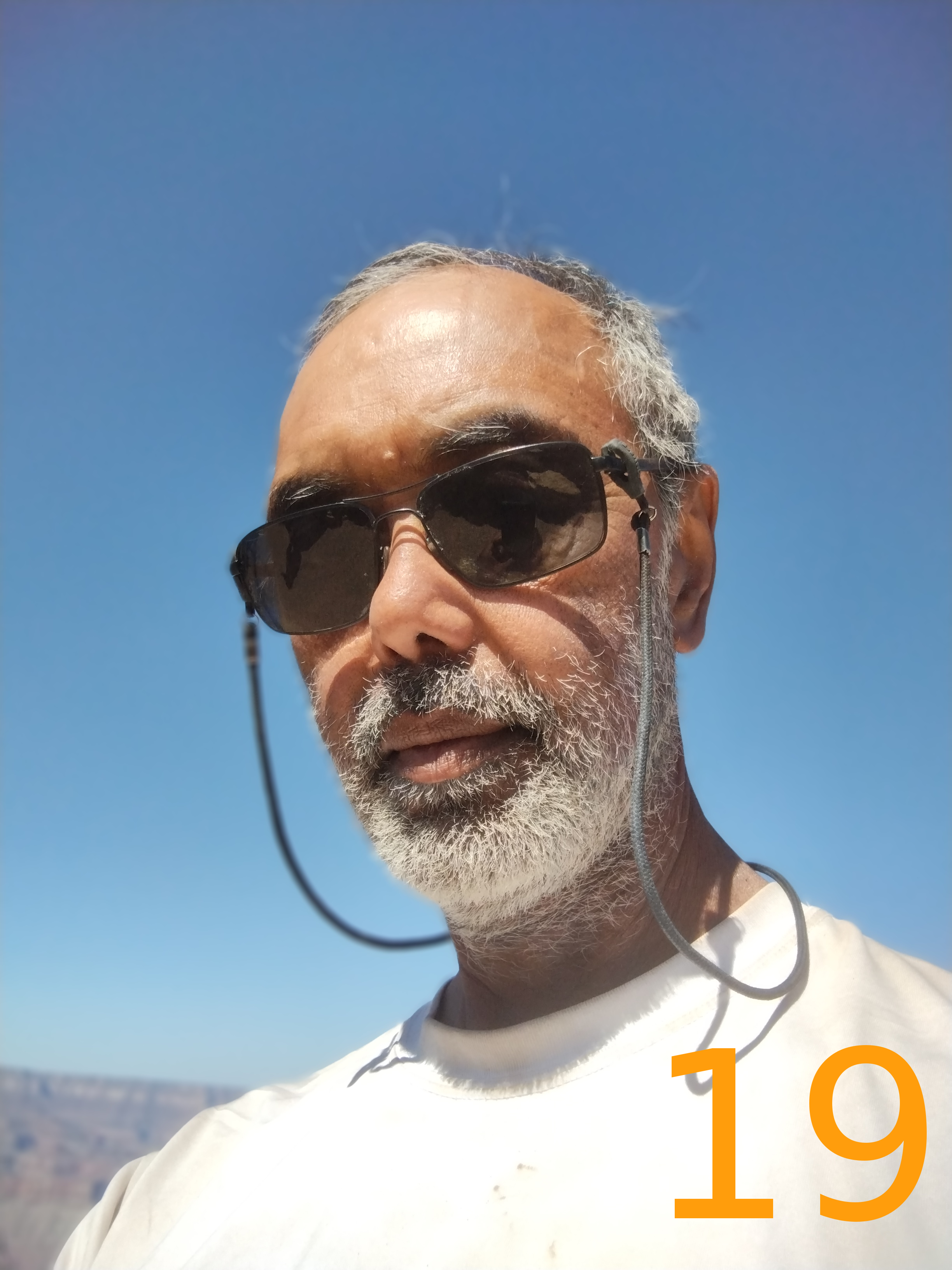
Finally, a bit of vanity. I had never gone without shaving for a stretch this long, and was curious about how my facial hair would progress, so I took a selfie (almost) each morning of the hike:

|

|

|

|

|

|

|

|

|

|

|
|

|

|

|
|

|

|
|
All in all, this was a challenging but also very fulfilling trip. I hope I have a chance to attempt it again. Though probably not for this long!


No comments:
Post a Comment