The weather gods laughed. The planning-season forecasts had been for a dryer-than-normal La Niña winter, but the reality turned out to be extraordinarily wet. We ended up cancelling a hike in mid-January due to an incoming storm, and had to make last-minute changes to our plans for the spring break hike at the beginning of March because the road to the trailhead was closed due to snow with another big storm coming in. Getting to GCNP became a challenge in itself due to various highway and road closures because of the storm. After discussing various alternatives we decided that it would be best to wait a couple of days for the storm to pass and the roads to be cleared, then show up at the Backcountry Information Center (BIC) and figure out something workable.
Layne, Tom, and I piled into Tom's truck in the morning and headed north. After a brief gas-and-lunch stop at Flagstaff we drove straight to GCNP and headed to the BIC. We managed to get a permit for an eight-day trip to Hermit, Boucher, and the Gems. The drive back to Tom's cabin turned out to be a bit of an adventure because of deep mud from the rain and melting snow on the sparsely-traveled road to his cabin.
We woke up around 4 and headed out from the cabin around 5:30. The ground had frozen overnight and was quite firm, and despite the deep ruts from the drive in the previous afternoon we had no trouble getting out. When we got to the trailhead there was just one other vehicle in the parking lot. Patches of snow blanketed the ground.
We put on our Yaktrax before putting on our packs and heading down. The top section of the trail had a lot of ice and crusty snow, and a bitter chill wind added to the sense of desolation.
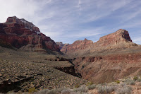
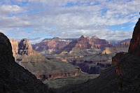
The snow thinned as we descended, and we were able to take off our Yaktrax by the time we reached the bottom of the Coconino layer. There were still the occasional stretches of snow and ice across shady parts of the trail, however, and these needed some care while crossing. The wind, which the forecast had said would die down by mid-morning, kept up most of the day. The sky stayed overcast, the colors of the cliffs muted.
We reached Santa Maria Spring fairly soon, but the Supai traverse after that seemed long. I was tired by the time we reached Hermit Creek, and the last 1½ miles to Hermit Rapids seemed to take forever; a sore Achilles tendon didn't help. We finally reached the Rapids around 4; Layne's GPS said we had covered 12 miles. After the usual camp setup chores. a quick dinner, and a game of chess with Layne, I headed into my tent around 6.
Day 2: Hermit Rapids to Boucher Creek
We had a relaxed start, rolling out of our sleeping bags around 6:30 and on the trail by 8:30. For most of the day there was a slight haze; once in a while the sun would break through enough to cast discernible shadows. The temperature was very pleasant and hiking along the Tonto was pretty straightforward, but I felt tired all day and moved slowly, and the seven miles from Hermit Rapids to Boucher Creek seemed to take forever. We reached Boucher Creek around 4:30. I didn't stay up long after dinner.
Day 3: Boucher Creek to Slate Creek
The goal today was to hike over to Slate Canyon, about five flat(ish) Tonto miles away. We had a leisurely start, getting on the trail around 8:30. The trail followed Boucher Creek downstream for maybe a quarter of a mile, then turned west at the junction with Topaz Canyon and rose steeply up a rocky hillside until it reached the level of the Tonto Platform and flattened out.
The weather was delightful: the sky was mostly blue and sunny, the temperature pleasantly warm. The trail wandered along the edge of the Tonto platform for a couple of miles, more or less following the Colorado hundreds of feet below us, then veered into the Slate drainage. After what felt like a long time, with many of the twists and turns typical of the Tonto, we reached Slate Canyon. A couple of hikers had set up camp near where the trail crossed Slate Creek, but Layne spotted some great campsites a little further up canyon. After setting up camp we just sat around and relaxed and enjoyed the afternoon.
We had left the Rim a couple of days ago in what seemed like the depth of winter. But trees were beginning to bud down at the level of the Tonto, and there were flowers here and there along the trail. Spring was coming!

Later that night, lying in my tent, I could hear the soft sound of water running down Slate Creek. It's a modest little stream: where Hermit Rapids roars and Boucher Creek babbles, Slate murmurs quietly. In the quiet of the night, it's a pleasant and companionable presence.
 |
| Slate Creek |
The creek runs down a wide channel of thick red rock slabs. Upstream from our camp its modest waterfalls were cheerful but not exuberant; downstream from our camp, just below where the trail crossed the creek bed, the stream plunges down several high pour-offs and the canyon narrows considerably.
Days 4 and 5: Slate Canyon
 |
| Slate Canyon camp |
I guess neither Tom nor I were feeling in the mood for a lot of hard hiking. After some discussion, we decided on a slight change of plans: instead of backpacking across the next few Gems canyons, we decided to set up base camp at Slate Canyon and day hike to across to Agate Canyon, about 3½ miles to the west.
The hike to Agate was pleasant. The sky was mostly quite overcast, which kept temperatures cool. The trail climbed gradually out of the Slate drainage, then veered west along the edge of the cliffs to our right, roughly paralleling the Colorado, which was running a thick muddy brown far below us. The basement cliffs alongside the river seemed different from the black Vishnu schist further east at Boucher or the Inner Gorge: here the cliffs seemed a lot more reddish-brown, with thick ropy intrusions of lighter orange-ish rocks. As we hiked further west the cliffs became entirely brown. After a while the trail turned into the Agate drainage and became faint and indistinct, and it took some looking, together with occasional educated guesswork, to figure out where to go.
 |
| Sunset: Slate Canyon |
We reached Agate around 12:30 and had lunch, after which Layne darted up-canyon briefly to explore. We headed back towards Slate shortly after he returned. The evening was cooler than previous days, and the low overhanging clouds and chilly breeze made it seem as though there might be rain coming. Later in the evening, lying in my tent and listening to the wind gusting outside, flapping the tent's rainfly noisily every so often, I was glad to be warm and snug and comfortable.
The next day (Day 5) was slow and lazy. After a leisurely start, we headed for a little rock pillar down in the canyon a short distance downstream from our campsite. We contoured back along the Tonto until we were more or less abreast of it, then scrambled down the steep rocky slope. The descent wasn't straightforward, but it wasn't terribly difficult either. Once we got to the pillar and got done taking pictures, we sat around, relaxed, and enjoyed the views, shifting around into sunlight or shade depending on whether we were cool or warm as the sun moved across the sky. The day had started hazy and overcast, but it cleared by mid-afternoon and we had bright sunlight and clear blue skies.
Eventually we headed back to camp, reversing our way uphill. A quick dinner, more relaxed and pleasant time hanging out together, a friendly chess game, and then, once Venus had dipped behind the cliffs across the canyon and Orion was faintly visible, it was time for me to head to my tent.
Days 6 and 7: Back to Boucher Creek
The day began on a damp note. I was in the process of breaking camp and organizing my pack when Layne called out, "It's raining!" Layne's tent was just a little bit up-canyon from mine, and it took just a moment longer for the rain to reach me. We hurriedly retreated to our respective tents; breakfast was eaten alone behind the shelter of my rainfly. Mercifully, the zipper on the rainfly, despite having been temperamental throughout the trip, cooperated and held together.
After a while the rain paused briefly, just long enough to let us pack up camp without getting drenched. It began raining again as we began hiking back towards Boucher—just a light spatter, but when the breeze blew it felt cold. The cliffs in the distance ahead of us were lost behind a veil of low clouds and mist. We wondered, with some worry, what we might be heading into.
 |
| Boucher Creek camp |
We made good speed across the Tonto. Encouragingly, the on-again off-again drizzle let up around 11, although the sky stayed dark and gloomy. We reached the descent from the Tonto into Topaz Canyon a little after that, and were back at Boucher Creek about an hour later. The place was deserted, and we had our pick of sites.
The rain, which had held off while we set up camp, started up again shortly after we'd had a quick lunch. The rest of the afternoon was on-again off-again rain showers. We had just enough time, in between cloudbursts and camp chores, for a quick game of chess (which I lost). Occasionally the sky would tease us with patches of blue, but thick gray clouds would invariably roll in and the rain would send us back inside our tents. Later in the evening it grew wildly windy—I was startled awake by the violent shaking of the tent. We could hear the low freight-train roar of the wind starting up far up the canyon, the descend howling on us, grabbing and shaking the tent hard before moving on. This went on all night, and didn't make for a restful night's sleep.
The wind eventually died down early the next day (Day 7), but it began raining quite heavily, the sky covered with thick dark threatening clouds. I spent a couple of frustrating hours trying to download a weather forecast on my Zoleo. None of us had any enthusiasm for a long hike over to Monument Creek (which is where our permit had us) in the rain, and eventually we decided to hike out the next day on Boucher; our tentative plan was to hike up and camp overnight by the potholes below Yuma Point, then head to the Rim the last day.
Much of the morning consisted of stretches of heavy rain and strong gusting winds alternating with clear stretches with occasional patches of sunshine. The rain petered out as the day wore on: there were still plenty of thick dark clouds scudding across the sky above us, but the small patches of blue eventually became bigger, the rainy stretches got shorter, and the dry stretches between them got longer.
As we were finishing lunch, a hiker who had camped nearby came by and told us breathlessly about an archaeological site a little way up the canyon. Tom and I had hiked up Boucher Canyon on a previous trip but knew nothing about what seemed to be, from his description, some pretty spectacular ruins—so, of course, we had to investigate. After some strenuous scrambling we found a site that, while interesting, did not quite live up to the hype.
The time taken up by this exploration delayed us enough that we had no hope of making it up as far as Yuma Point in daylight. We decided to stay at Boucher Creek that night and hike all the way to the Rim the following day. With that detail settled, we sat around and relaxed the rest of the afternoon.
Thick clouds rolled in again shortly after it got dark, and soon it began to rain in earnest together with fierce tent-shaking gusts of wind. Our last night at Boucher would be a wet and windy one.
Day 8: Boucher Creek to the Rim
We were on the trail around 7 AM. The trail climbed steadily and steeply until we got past the Redwall and reached the flat open area by Whites Butte, about 1.7 miles and 2000' of elevation from Boucher Creek. We stopped briefly for a pleasant lunch break, then shouldered our packs and headed on.

|

|
| L: Approaching the Redwall Cliffs |
| R: The crux section in Travertine Canyon |
When we were getting our permit at the BIC for this hike, the ranger had casually mentioned a rockfall in Travertine Canyon. Considering that Boucher is likely the most difficult trail on the South Rim, and Travertine Canyon one of its gnarliest sections, the very fact that she had considered the rockfall worth mentioning seemed ominous. So, as the trail moved away from Whites Butte and entered Travertine Canyon, I was naturally curious about where we would encounter it and what it would be like. The rockfall turned out to be right at the crux move in Travertine Canyon: what used to be a (short but not insignificant) hand-and-foot climb had been turned into a steep loose mess of rocks slippery with mud from snowmelt. The rocks were unstable enough that it didn't seem safe for the three of us to climb through together; instead, Tom went up first while we waited off to the side at the bottom of the climb, then I went up once he was clear, and Layne came up once I was done.
By mid-afternoon we reached the potholes below Yuma Point and stopped to fill up on water. Bones from a bighorn skeleton lay on the ground not far from the trail—the fourth set of bighorn sheep remains we had seen on this trip.
The stretch from Yuma Point to the junction with Hermit Trail was an undulating, and seemingly interminable, traverse along the Supai layer around the east side of Eremita Mesa. I remember looking up at the Coconino cliffs a short distance above us as we started out on this stretch; an hour or so later they were still just as far away. There's actually a net loss of elevation of about 150' over this 2.5 mile stretch, dropping from 5430' at Yuma Point to 5280' at the trail junction, though the ups and downs of the trail add up to quite a bit more of total elevation change (Caltopo claims +450' -660'). I think this stretch of the trail feels especially long and tedious coming up Boucher because by that time one is tired and ready to be done with the hike.
The final leg, from the Hermit Trail junction to the Rim, was about 2.7 miles and 1360' of elevation: modest, especially by Grand Canyon standards, but we were tired and it felt like a lot work. Layne had gone ahead of us, and we eventually found him waiting by the side of the trail talking to a group of day hikers. The last stretch of trail went slowly. The sun was setting as we reached the trailhead at around 6:30 PM.
 Later that night, lying in my tent, I could hear the soft sound of water running down Slate Creek. It's a modest little stream: where Hermit Rapids roars and Boucher Creek babbles, Slate murmurs quietly. In the quiet of the night, it's a pleasant and companionable presence.


No comments:
Post a Comment