Monday, September 12, 2016

Canadian Rockies (July 2015)

In mid-July 2015, a group of us—my high school friend Nirmal, now living in Alberta, Canada; Claudette, Dan, and Nicole, friends of Nirmal, also from Alberta; and Tom and I—spent a week backpacking in the Canadian Rockies.  The original plan had been to hike the famous Skyline Trail, but a wildfire closed that trail just a few days before our hike, and our resourceful Canadian friends quickly put together a Plan B trip over some utterly gorgeous countryside.


Tom and I had made our ways up to Canada separately: he had driven up from Tucson (part of the way with Linden), stopping at various national parks along the way, while Wendy and I had flown into Calgary and spent a week exploring the area around Banff.  We eventually got together in Calgary, the wives flew back to Tucson, and Tom and I drove up to a little town named Red Deer, halfway between Calgary and Edmonton, to meet Nirmal.

Day 0.  Tom and I drove over to Nirmal's house after breakfast on July 18.  We threw our stuff into the back of Nirmal's pickup, picked up Dan, who lived not too far away, then headed west towards the mountains.  The drive was pleasant and relaxed: we took a short detour along the way to see Crescent Falls, a large and very cool two-storey waterfall, and reached Abraham Lake around 3-ish.

Crescent Falls
Abraham Lake is a large artificial lake whose water is such a beautiful blue that it looks fake, and we desert folks weren't accustomed to so much water in any case, so for a little while we just walked up and down admiring the scenery.  Then Claudette and Nicole, the other members of our hiking party, showed up, and we piled back into our vehicles and headed to our campsite beside the lake.  We'd brought along several different kinds of liquor, and festivities ensued.

Abraham Lake
Day 1.  After breakfast the next morning we broke camp and headed out.  Conversation was subdued, possibly a consequence of the previous evening's festivities.

We ran into our first glitch once we got to the trailhead: Nirmal's hiking boots weren't in his truck.  After some discussion, we decided that three of us would hike ahead slowly while the other three drove back to get the boots; we agreed to rendezvous at a campsite a few miles up the trail.

The Trail to Pinto Lake: Day 1
Claudette, Tom, and I hiked up the trail at a relaxed and leisurely pace.  The scenery was gorgeous, the trail delightful, the weather perfect.  We reached the designated rendezvous, at the campground by the junction of Shoe Leather Creek and Cline River, around lunch time, fully expecting the rest of the crew—Dan, Nicole, and Nirmal—to come barrelling down the trail any minute.  We waited... and waited...  and were beginning to get worried when, fairly late in the afternoon, they finally wandered into camp looking tired and ready for a break.  It turned out that they had lost the trail early on and bushwhacked most of the way to the campsite.    It was late enough, and they were tired enough, that we decided to camp there for the night.

Our campground was right beside the Cline River.  The scenery was gorgeous: on one side there was the swift-flowing Cline River, flanked by patches of bright purple-red fireweed; on the other, thick forest.   Clouds scudded across the sky, their shadows racing across the landscape.  And no people! This was wonderful beyond words!

Views from Shoe Leather Creek Campground
Relaxing
Day 2.  The trail heading west out of or campsite was obvious enough (at least initially), but also confusing—at least initially—because of all the braiding around two trails coming together, though the various braids merged together soon enough.  The hiking was delightful, though at one point we lost the trail for a little while and ended up bushwhacking through the forest for a bit; in the process, I learned how different forest bushwhacking is from desert bushwhacking, and how much work it is to go over and around and over and around all the fallen tree-trunks lying around everywhere.

An interesting aspect of the hike was our "bear shouting".  The idea was to make enough noise that we wouldn't surprise any bears.  Bear bells were ineffective, and carrying on a loud conversation got tiring quickly, so instead every few minutes someone in the group would yell out.  The interesting thing was that, while from the bear's perspective it didn't much matter what we yelled, we didn't want our yells to alarm any other hikers who might be within earshot.  So most of the time our yells were some variation of a friendly "'Allo bear!"  greeting.  If Pooh had been in the neighborhood I'm sure he'd have greeted us back.

The trail mostly followed the Cline River and didn't involve a whole lot of elevation change.  As we got closer to Waterfalls Creek, at one point we realized that we needed to be on the high ground above the cliffs flanking the river; the hike up the almost-but-not-quite-vertical cliff face was breathtaking.  Once we got to the top, so were the views.


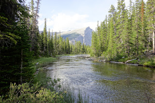
We reached Waterfalls Creek campground in the early afternoon.  The scenery was gorgeous: the Cline rushing along right beside the campground, thick stands of bright green conifers lining the banks on either side, and behind them mountains rising jaggedly into the sky.
Views: Waterfalls Creek Campground
Day 3.  The goal today was Pinto Lake today (10 miles; 16 kms).  The trail continued alongside the Cline, pleasant and mostly fairly level.

Nirmal and I The Crew
The sky began clouding up after a while and we had a couple of brief drizzles as we hiked—and although we broke out the rain jackets and pack covers, the showers were light and brief.  The weather in the mountains of Alberta is fickle!  A saying I heard repeated several times was, "If you don't like the weather in Alberta... just wait five minutes."

Remnants of an old log bridge
Mingling of waters: Cline River and unnamed creek
We reached Pinto Lake mid-afternoon-ish.  It was beautiful—but, lest we get effusive-praise-fatigue, it's important to put that adjective in context.  We're not accustomed to large bodies of water on our hikes in Arizona: I've heard it said that in the Desert Southwest, a lake is any puddle that lasts three days.  Even so, after a week of sightseeing and several days of hiking in the Canadian Rockies, it's easy to become blasé about scenery.  But, even after compensating for all that, Pinto Lake was lovely.  The crystal water shaded over from clear by the bank to a bright blue-green and then into a deep blue further out.  A light breeze ruffled the surface of the water, pushing little ripples across the lake and making bright bands of sunlight shimmer across the lakebed.  I could've sat and watched this for hours!
Pinto Lake colors: afternoon (L) and morning (R)
Pinto Lake: morning stillness

Day 4.  Some early-morning excitement.  Most of us were still sleeping in our tents when a moose that was grazing nearby was startled by Nicole walking by and galloped right through the middle of camp with a loud clatter of hooves.  Our first Big Critter of the trip—at about the size of a horse, it seemed small for a moose, so maybe a juvenile.  The ruckus got people awake and moving.

Undercover dinner
After breakfast we packed up and headed east back towards the Waterfalls Creek campground.  By and large we followed our way in, though there were places where we went a different way; and of course things looked different from the other direction.  So the hike back was just as enjoyable, and just as fresh, as on the way in.

Later that day, as we were setting up for dinner, Dan (who had been off getting water) came rushing in to report a storm moving in.  We hurriedly set up some tarps to shelter under.  Dinner was cozy, but—thanks to Dan's timely warning—dry.  The storm didn't last long: as they say, if you don't like the weather in Alberta, wait five minutes.

I think it may have rained again later, but by then we were in our tents.  There's something wonderfully soothing about the sound of rain on the outside of a tent when you're all warm and snug inside the cocoon of your sleeping bag.  It reminds me of boyhood days in Kohima and Shillong, snuggled up under the covers, listening to the pounding of the monsoon downpour on the corrugated tin roof.

Day 5.  Getting packed up in the morning took a little longer than usual because we tried to get our tents---which were wet from yesterday's storm---to dry a little.   So the scene at breakfast was of tents festooned all over and between trees all around the campground.  Our Canadian hosts also showed us a way to get the water off wet tents: you pair up, grab opposite ends of the tent, and shake vigorously in unison.  The whole process of transforming tents from "wet" to "only somewhat damp" is surprisingly quick and efficient.

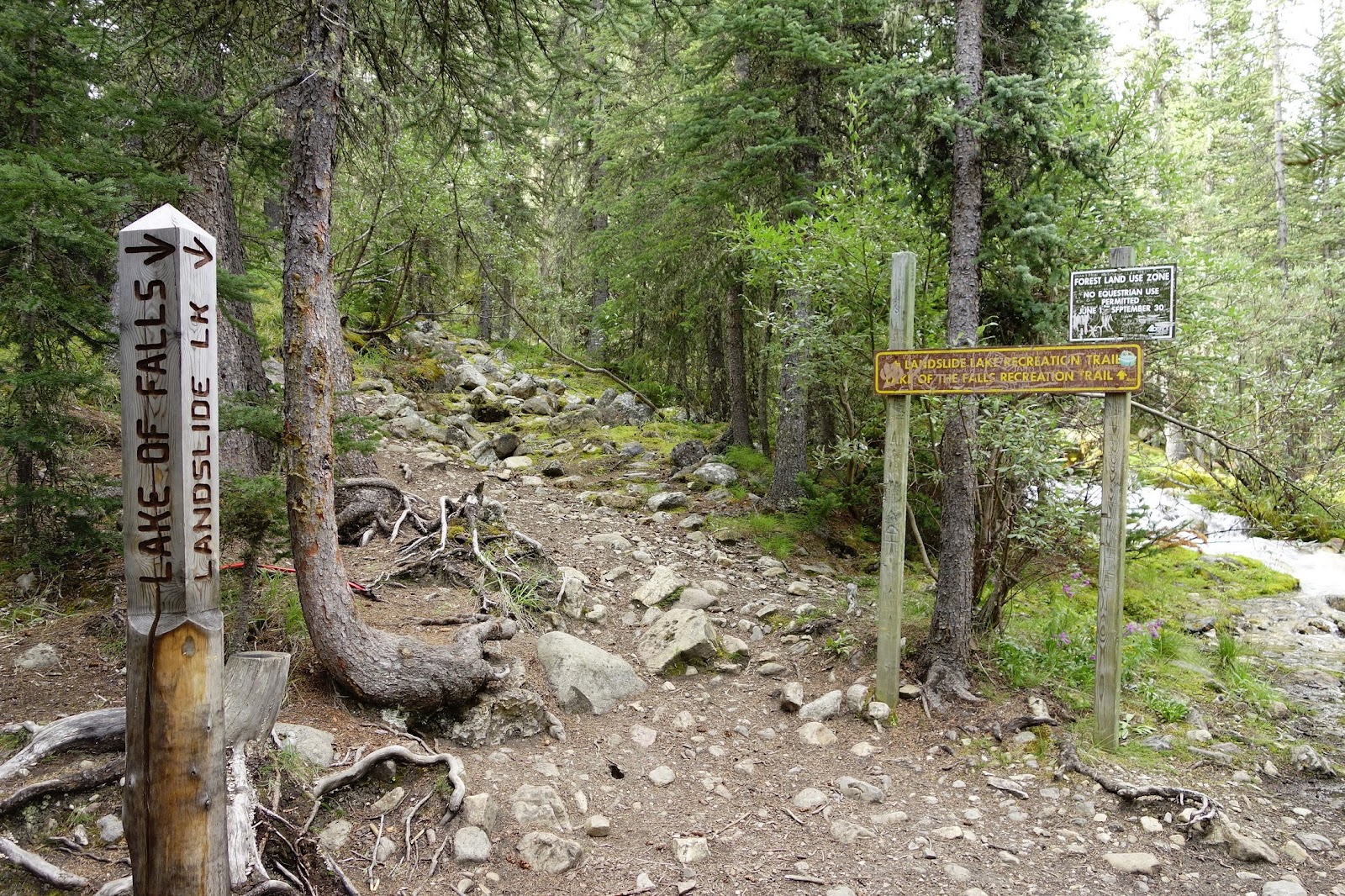
We followed the Cline River back to where it met Shoe Leather Creek; but before we reached the actual campground (where we'd spent the first night), we swung right and headed south towards Landslide Lake.  The trail was definitely more challenging than that to Pinto Lake: steeper and narrower, the streams wilder.


We reached the confluence of Entry Creek and the outlet creek from Landslide Lake around mid-afternoon.  Landslide Lake wasn't all that far away from here, but it had been a respectable day's hike and people were tired, so we decided to camp there for the night.  The "campground" was small and there wasn't a lot of room for all of our tents, with a few cramped campsites perched precariously on a steep hillside.  But other than a having to climb up or down a bit of hill to get anywhere, this worked out fine.

Day 6.  The final stretch to Landslide Lake, not too far away.  Even with a relaxed start, we reached the northern tip of Landslide Lake around mid-day.  Along the way, just a little north of the lake itself, we passed through several good-sized rockfalls: large fields of dark-gray boulders.  From the size of the trees beginning to push their way through, the rockfalls didn't seem all that old: maybe a couple of decades.  Whenever it happened, it must've been pretty loud!

Landslide Lake is a long narrow lake running roughly north-south.  It's supposed to be a popular hiking and fishing spot but, while we saw some trash at the campground, we didn't see any other people while we were there.  The campground sat just off the lake shore, maybe twenty feet above it; the hillside continued rising behind the campsites, again covered with rockfall, for maybe a hundred feet.  The view from the top of the rockfall, once you got up there, was stunning.


Much more than the campgrounds we stayed at along the Cline, Landslide Lake had many different kinds of colorful wildflowers blooming all around (for example, I counted four different kinds of Indian paintbrush alone).  There was also an intriguing little waterhole near the campground that, from the many animal tracks all around, looked like it was visited by wildlife.  We toyed with the idea of setting up Dan's camera in motion-sensing mode, but in the end didn't.

Indian paintbrush by Landslide Lake campground

Day 7.  Our hiking-out day.  After breakfast we packed up and headed south, following the east shore of the lake.  Although the day had dawned with some blue in the skies, by the time we got on the trail, around 8-ish, it had clouded over.  By the time we were about halfway down the side of the lake it began to drizzle lightly.

As we were heading down by the side of lake, we came upon what is one of the most incongruous sights in all my days of hiking: a bicycle, sans front wheel, parked neatly on the lake shore.  Someone had gone through a lot of trouble to drag that thing there!

Landslide Lake at dawn
The bicycle Raingear and pack-cover break
From the south end of the lake, the trail climbed about 3,600 feet (1,100 m) up to a pass at about 8,200 feet (2,500 m), then down the other side to the trailhead.  The trail became very faint as we left the lake, and at some point we zigged when we should have zagged and headed up the wrong drainage for a little ways before realizing our error and getting back on track.  A little ways into the uphill climb we saw a herd of mountain goats grazing on the hillside across from us, which was very cool.

Mountain goats

The vegetation grew sparse as we climbed higher and approached the tree line.  The few trees that there were grew in small scattered stunted clumps.  The hills around us were shrouded in clouds, and there were patches of snow on the ground.  It all looked very tundra-like; meanwhile we were huffing and puffing and perspiring freely inside our rain-jackets as we labored up the trail.  The scenery, the plants, and the weather added up to quite a unique experience, and if I hadn't been so tired and out of breath I'd have taken more photos (I should have).

Landslide Lake seen from part-way up the hill Approaching the tree-line
Eventually we came to the pass: the hill flattened out and then dropped away, the landscape opened up in front of us.  We sat and panted and wheezed for a little bit, then picked up and moved on.  The trail contoured along for a little bit and then began to drop down into the valley below.

The descent was steep!  Up at the top there was a long section of loose scree that slid with each step: not too bad (and maybe even fun) to descend, but it must make for hard ascents!  Then we passed through a section of forest that had burned from a fire some time ago.  The vista of the broad valley in front of us, with high cloud-shrouded peaks beyond, was gorgeous, but our fatigue cut into the appreciation.
View of the valley during the descent

We weren't too far from the bottom when we ran into a mother and her teenage daughter heading up the trail.  The mother asked us how much farther it was to the top, and seemed taken aback when we burst into laughter.  We talked her out of the hike, and they turned around and came back down with us.

Prayer flags near Landslide Lake trailhead
We reached the valley floor soon after that.  As we walked towards the parking lot, we passed through a forest of aspen trees that had Native American prayer flags tied to them.  Although I knew nothing about them, just the thought of prayer offerings to the Spirits put me in a contemplative mood.  I had just had the wonderful fortune of spending a week walking through some truly gorgeous country with a group of wonderful people, and in the process made new friends and renewed old friendships. A prayer of thanks seemed appropriate.


Sunday, August 14, 2016

Grand Canyon (Tanner/Beamer/Little Colorado): Oct 2015

In mid-October 2015 we (my friends Herman and Nancy, and Tom, and I) spent a week hiking the Tanner and Beamer trails to the Little Colorado (LC) and back.  I had heard a lot about, and always wanted to see, the turquoise waters of the Little Colorado flowing into and mixing with the dark green waters of the Colorado, and Tom thought we'd have enough time on this trip to hike up the Little Colorado to the Sipapu ("place of emergence"), which is sacred to the Hopis.  As it turned out (and as our friend Larry had correctly predicted), an exceptionally strong El Niño season didn't lend itself to clear turquoise LC waters.  But the hike was memorable regardless, with much to look back on fondly.  Also, character was built.

(Nancy had been suffering from a painful case of plantar fasciitis in the weeks leading up to the hike, and even just a few days before the hike, her ability to go on the hike—and, therefore, Herman's as well—had been in doubt.  That she ended up hiking the entire distance, over some very challenging terrain, speaks to an amazing level of determination and fortitude.)

Day 0.  We drove up from Tucson on Fri Oct 9; since this was a work day, we left Tucson late in the afternoon.  It was long after dark when we pulled onto a dirt road on National Forest land near the East Entrance to GCNP, found some flat space, made camp quickly, and turned in for the night.

Herman making breakfast
Day 1 [Oct 10]. After a huge breakfast of eggs and bacon that Herman whipped up, we headed over to into GCNP.  We had decided to spend our first night in the Canyon at a flat spot just below the Redwall and get to the Colorado the morning of the second day.  Breaking up the hike this way meant that we wouldn't have to hurry and could set a comfortable pace; the downside was that our packs would be heavier because of the extra water we'd need for the dry camp the first night.

Since we wouldn't be travelling too far this day—roughly five miles or so—we didn't have to rush to start the hike, so we took a brief detour via the Desert View Watchtower and were on the trail shortly after 8.  The trail descends steeply from the rim down to Seventyfive Mile Canyon saddle, dropping 1,700 feet in just under two miles in what the National Park Service's Tanner Trail description refers to as "notably insecure hiking".  Between the weight of our packs, and the issues with Nancy's feet, we took this section of the hike carefully and got to the saddle around 10am.

Seventyfive Mile Canyon  Stegosaurus Rocks
The trail leveled out for the next three miles, contouring along the base of Escalante and Cardenas Buttes until we got to the top of the Redwall.  The Park Service trail description calls the Redwall descent "nasty—steep and loose", but it didn't seem quite that bad to me, either on the descent or on the ascent.  We made our way down carefully and uneventfully and some time around 3-ish got to the flat area where we'd be camping that night.  It felt good to take our packs off, but the sun beating down on us was pretty hot and there wasn't much in the way of shade except for a few scraggly bushes.  Beggars, choosers, etc.: we made do with what shade we could find and waited for the sun to sink lower.  We may have broken into our Drambuie—I don't remember (which perhaps is suggestive in itself).

View from the top of the Redwall
Views from our campsite below the Redwall

Day 2.  After breakfast we broke camp and headed down towards the river.  It wasn't all that far to the river (maybe 4 miles), and hiking in the early-morning cool meant we didn't need a whole lot of water (we'd refill at the river), so our packs were quite a bit lighter than they had been the previous morning, and the hiking was very pleasant.  Except for a steep and rocky section right below our campsite, the trail wasn't too bad.  We reached the river around 11:30.

Views on the hike down to the river

Our first surprise: we found the Colorado running brown and thick with mud and silt. This was a bit of an inconvenience when pumping (i.e., purifying) water because of the frequent need to dismantle and unclog our water filters, but we didn't think too much of it beyond that. We must have figured, or hoped, that the river would clear up as we headed upstream. Little did we know how forlorn a hope this would turn out to be.

The Colorado running muddy at Tanner

By early afternoon, having had lunch and taken on water, we left Tanner and headed east along the Beamer Trail for Palisades Wash about three miles away.  The trail wasn't too challenging terrain-wise, but the sun was bright and hard above our heads and the heat was enervating.  By the time we arrived at Palisades, around 4 pm, we were pretty beat.

A group of rafters had pulled in just before we arrived and were setting up camp near the river.  They offered us cold beer, which tasted absolutely delicious after the heat of the hike.  More importantly, we found out that the Colorado was running muddy all the way up to the Little Colorado—in fact, the LC was the source of all the mud!  Visions of a turquoise-blue LC evaporated.

More problematic were the implications of the silt for purifying water.  Earlier in the day, at Tanner, I was getting maybe ½ – ⅓ quart of water from my pump before the filter clogged up and needed to be cleaned, which meant that getting a day's worth of water (hike plus meals, about 5–6 qts) was slow, tiring, and frustrating; Herman's pump couldn't be field-cleaned, but needed to be back-flushed with clean water, which obviously posed a problem; and Tom had a steri-pen, whose effectiveness was limited in cloudy water.  We had buckets that we could use to let the silt settle out—this made the pumping easier, but also meant having to wait for several hours before we could actually pump water.  To compound matters, we were going through a mini heat-wave the week of the hike: the official "in the shade" temperatures in Tucson—roughly comparable to (maybe slightly cooler than) the bottom of the Canyon—for the week were in the 90s; and on the sun-exposed trails we were hiking, our thermometers read over 100°F even fairly late in the day.  The heat, of course, meant we'd need a lot of water.  This combination of circumstances was worrisome and weighed on us that night.

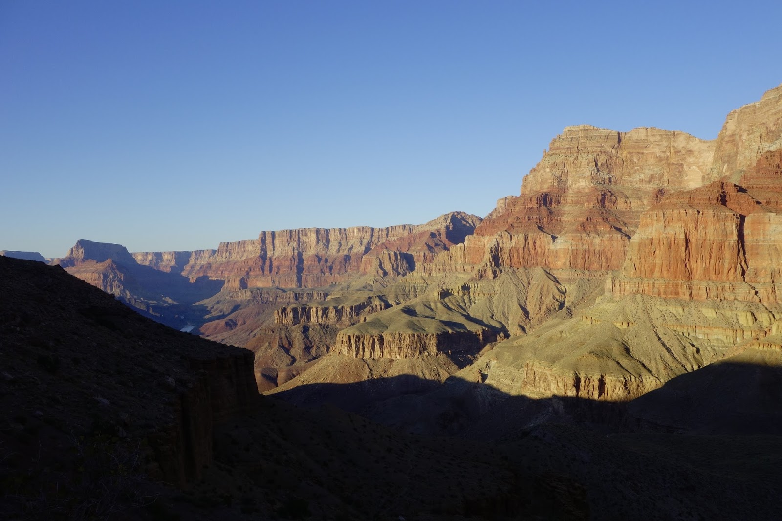
And yet.  The Grand Canyon is a magical place, and whatever worries we may have had, about heat or silt or whatever, faded away before the gorgeous vistas all around us.  As the day gradually faded, the cliffs glowed in the late-afternoon light that changed from minute to minute.  It made you wish for a pause button to the day, so you could take your time to admire and enjoy the harsh loveliness all around before it faded away into the evening.

Views from Palisades Beach
But reality is stubborn, and demanded to be appeased once the magic of sunset had faded.  And so, in preparation for the next day's hike, we spent several hours before going to bed pumping water from our buckets by headlamp-light.

Day 3.  We were up before dawn in order to hit the trail early and cover as much distance as we could before it got too warm.  Our goal was to hike about six miles to a campsite near the confluence of the Colorado and LC (the area immediately around the confluence is closed to overnight camping).

The narrow trail at the edge of the cliffs The long drop

The trail headed north from our campsite, crossing Palisades Wash and then climbing about 300 feet to the top of the Tapeats and following the river all the way to the LC.  There was a long section where the trail was very narrow and skirted the very edge of the cliffs; the exposure, with a sheer drop all the way down to the river, focused one's mind.  Eventually the exposure dissipated, but then the trail began going in and out of side drainages in order to follow the contour, which got old pretty quickly: we could see where we needed to be on the other side of the drainage, not far away, but we had to do this detour to get there.  It wasn't as bad as some of the detours on the Tonto, but there were a lot of them (Herman counted upwards of two dozen from his previous visit to this area) and they added quite a bit to the distance we had to cover.

We got to the campsite in the early afternoon: a sandy stretch of beach a little ways downstream from the confluence.  It was hot, and we were tired, so we found what shade we could and hid.  Drambuie levels dropped.  A small rafting party went by, one of the rafters topless.  The day went by slowly and lazily.  By now we had grown accustomed (and resigned) to our water-pumping routine—haul as much water as possible into a bucket or container, wait several hours for the silt to settle, then pump the clear water on top—and so were feeling a lot less stressed about it, and the evening was pleasant and relaxed.

Right above our campsite: Cape Solitude
Looking upstream from our campsite

The confluence.  The LC is the muddy stream coming in from bottom right; the Colorado is the clear green water coming in from the middle of the picture.
Day 4. The plan for the day was to day-hike to and up the Little Colorado.  Our campsite wasn't far from the confluence, so it didn't take us long to get there.  From our vantage point a couple of hundred feet above the two rivers, the view of the mixing of their waters was fascinating, though not quite what we had originally hoped for: the LC, coming in from the east running thick and brown and silty, colliding with the clear green of the Colorado and turning everything into a muddy mess.

The Little Colorado near the confluence
When planning this hike, we had intended to go up the LC to the Sipapu.  That would necessarily involve a fair amount of wading in the LC, which now seemed iffy because of the fast-flowing water where we couldn't see where we were stepping.  After some discussion, we decided to abandon our plans to get to the Sipapu and just hike up the canyon instead.

The wander up the canyon of the LC was pleasant, if warm.  We found Ben Beamer's cabin, dating from around 1890, under an overhang close to the confluence.  Some time later, to our surprise, we came across a bunch of telemetry gear perched above the LC, possibly to monitor its level and/or flow—completely unexpected this far out in the wilderness.

Beamer's Cabin

Seeking shade under a rock ledge
Tom checking out some telemetry gear

It got pretty hot pretty quickly as the morning wore on, and there wasn't much shade on the trail.  In an attempt to cool down, we took to wetting our shirts and bandannas in the river—a sopping wet shirt would last for maybe half an hour before drying out, and we'd repeat the process.  After a few rounds of this my shirt was so stiff from leavings of the evaporated river water that it felt like it had been starched!

On the way back we happened upon a faint trail that paralleled the LC, which we'd missed on the way up and which made the hike back a little bit easier.  The prospect of spending the afternoon on a sandy beach with very little shade wasn't too appealing, and Tom and I ended up hanging out in the shade of a cliff for several hours until the day cooled off a little.

Back at camp
The entire week of our trip had been fiercely hot, with afternoon temperatures in the 90s in the shade and well over 100°F on  the trail, which offered very little shade.  This limited the amount of enjoyable hiking time.  It also increased the amount of water we needed, and pumping/purifying the thick silty water was no fun.   After discussing our options, therefore, we reluctantly decided to end the trip a day earlier than planned.

Day 5.  We woke up early and, after a quick breakfast, broke camp.

The early mornings are delightful.  The air is cool from the night and the bottom of the Canyon stays shady well into mid-morning.  Hiking is a joy: there's no hint of the heat that will devour you later in the day—though you know it's there, you can feel it in the crispness of the shirt that you starched in the river the day before.  I turned south towards Tanner with a mixture of regret and relief.

One of the things that never ceased to amaze me is the speed with which the Colorado changed its character.  There were places where its side canyons echoed with the roar of the rapids... and then, just a little later, the river would be quiet and calm, the cliffs beside it reflected in the stillness of its surface.

Shortly after we got on the trail, Tom spotted two bighorn sheep on the other side of the river.  They stood and watched us for a few minutes as we watched them.  A little later, we were startled by the loud yipping of a pack of coyotes (magnified by echoes off the cliffs above us).  They couldn't have been too far from us.  Tom thought that maybe one of them had spotted prey and was alerting the others; I hoped they weren't looking at us.

Entrance to Tanner's mine
The sun was pretty high in the sky by the time we got to Palisades Wash.  After lunch in the shade of some mesquite trees, we detoured to the entrance to Tanner's old mine at the foot of the cliffs above the wash before getting back on the trail.  We made camp for the night just north of Espejo Creek, roughly a mile south of Palisades Wash and about 7½ miles from our campsite near the LC.

Day 6.  The goal today was to hike over to Tanner Beach (about 2 miles), replenish our water, then head up Tanner Trail and camp above the Redwall (about 5½ miles, 3000 feet elevation gain).


The hike to Tanner was in shade and quite pleasant.  Once we began climbing out of Tanner, though, we were in full sun and it began to warm up quickly.  The combination of the heat, the weight of extra water for the upcoming dry camp atop the Redwall, and  the unrelenting uphill grade, made for slow going (it was, literally, nauseating; salt tablets helped).  After a while, we took cover under a small rock ledge and just waited out the next few hours of blistering heat.  We eventually made our way up the Redwall and made camp at a wide flat spot looking down over the Canyon.  The view, as the sun sank low and the light turned golden, was breathtaking: it made the day's slog well worth it.


Day 7.  The last day of the trip.  It was a cloudy morning and it looked like it could be raining farther out over the Canyon.  The clouds made for cool and pleasant hiking.  There was a beautiful rainbow arcing across the sky at Seventyfive Mile Canyon saddle—a farewell gift from the Canyon after a hard, hot week.


As we climbed out above the Coconino sandstone on the upper section of the trail we were drenched by a brief cloudburst.  We were back at the trailhead by lunchtime.

Postscript.  This trip description mentions "hot" a lot—I hope that doesn't come across as whiny, it isn't intended to be.  The National Park Service's Tanner Trail description says
"The Grand Canyon in general is infamous for summer heat and the Tanner Trail is specifically noted as  being unusually hot. The wide open nature of this part of the canyon means the summer sun comes up early and sets late. No water means no vegetation, and that means no shade. River runners call this part of the Grand Canyon "Furnace Flats". Avoid this trail during hot weather."
I can attest to the truth of this.

It would be easy to get the impression that the trip was a disappointment; it was not.  Certainly there were challenges—the heat, the lack of shade, the silty brown water—but mostly these were problems to work around rather than walls to crash against.  And once we'd figured out the work-arounds, we had the solitude, the silence, the stunning vistas, the cliffs glowing golden in the light of the setting sun.  I have yet to be disappointed by the Grand Canyon.

There were just two (related) things that we couldn't work around: the LC was missing its fabled turquoise blue waters; and we didn't make it to the Sipapu.  This simply means we'll have to go back in again.  I'm looking forward to that hike already!

Finally, I'd mentioned at the beginning that Nancy almost didn't come on this trip because of plantar fasciitis.  Amazingly, she hiked the entirety of the trip without any issues; she said later that the hike cured the problem and the pain went away!  We'll attribute this miracle to Saint Harvey, patron saint of Grand Canyon hikers.

Grand Canyon (Escalante Route): April 2026

A group of six of us—Bill, Brett, Layne, Logan, Ramesh, and I—went on a four-day backpacking trip in Grand Canyon in April 2026: down Tanner...