The Nankoweap Trail, off the North Rim of the Grand Canyon, is considered to be the "
." In March 2015, Herman, Tom, and I spent six days on a backpacking trip into the Grand Canyon down this trail.
We set out from Tucson early on March 15. It's a long drive to the North Rim: up I-10 and then I-17 through Phoenix to Flagstaff, then north along Rte 89 and Rte 89A to Lee's Ferry, where we crossed the Colorado (putting us to the north of the river), then west along 89A for a while before heading south down a long dirt road to get to the trailhead at the boundary of the wilderness area. We expected to get there by mid-afternoon, and the plan was to hike part of the way to the Canyon rim the rest of the afternoon and camp, so we could drop down into the Canyon with a minimum of wasted time the next day.
One implication of this plan was that we needed to set out from the trailhead with enough water for two dry camps. This made for heavy packs: they weighed in at around 65 lbs each when we started out. It's about 3.5 miles and 800 uphill feet from the traihead to the rim, and between the weight of the packs and the elevation (6,800' to 7,600') it was slow going. We decided to camp about half a mile from the rim. A stiff breeze sprang up as we began setting up camp, making the process of pitching tents more interesting than usual. But camp was set up soon enough, and after a quick dinner I curled up inside my sleeping bag, snug and dry and content, as the wind howled outside the tent and drove the pitter-patter of a light drizzle before it. I don't think I lay awake very long.
We woke up a little before dawn and began getting ready for the day: putting away our sleeping bags, packing up our gear, getting breakfast ready by the light of a headlamp. This would be my third trip down Nankoweap Trail, and yet the anticipation and excitement (and, yes, nervousness) was just as sharp and vivid as the very first time. The sky gradually lightened to the east, and the darkness around us slowly sorted itself out into silhouettes that solidified into trees. Not long after it was light enough to see the trail, we were on the move.
The "stumbling upon" the Canyon rim on this trail always catches me by surprise. There you are, hiking among the pine trees, then all of a sudden the land falls away abruptly, opening up this absolutely stunning vista. Even though I know what to expect by now, that first glimpse never fails to take my breath away!
After a brief pause to enjoy the view, we dropped down below the rim. The trail drops intimidatingly steeply at first through a rugged rocky stretch, but soon settles into a long traverse across the red Supai sandstone. The hiking is quite pleasant, with steep cliffs on one side of the trail, stunning views of the entire Nankoweap valley on the other.
 |
| Vista from Nankoweap Trail |
A significant milestone along the way, about three miles in from where we dropped down below the rim, is Marion Point, a long fin of rock that juts out into the canyon. There's a nice little flat spot at the top with room for some tents, and we had camped there on a previous trip; this time we just paused a little bit to admire the view and kept going.
 |
Marion Point |
 |
The Park Services's
trail description for Nankoweap emphasizes how exposed it is in places (
"This trail is not recommended for people with a fear of heights"), and this first becomes evident near Marion Point. The trail narrows to a little track, no more than a foot wide, with sheer rock cliff rising vertically on one side and sheer rock cliff dropping vertically on the other. It's not for the faint of heart!
 |
 |
| Cliff in the Supai |
Exposure |
By mid-afternoon we were down to just above Tilted Mesa. I was feeling a little tired from the heat by now, and there was a nice flat-ish area here with the next decent camping spot quite a bit further down, so we decided to stop and camp. There were some juniper trees that gave just enough shade for us to sit and relax and sip a little drambuie and enjoy the silence and the view.
As the day wound down and the shadows gradually lengthened in the softening light, the texture of the landscape began to come into relief. In the near distance in front of us, Tilted Mesa slanted off to the left; beyond that unfolded a crazy corrugation of canyons and ridges and buttes: Kwagunt, Malgosa, Awatubi. Little by little the shadows crept across the land. The clouds to the west caught fire, briefly, before darkness fell and the stars came out.
Day 2
It was still dark outside when I awoke. It was wonderfully comfy and cozy inside the sleeping bag and I really didn't want to get out and start getting ready for the day, but I could hear Tom and Herman moving around in their tents and knew I couldn't procrastinate for much longer. Once over the initial inertia, though, the morning routine—packing stuff up, making breakfast, taking down camp—was a familiar one and moved along smoothly.
Dawn broke as we were eating breakfast: at first just a lightening of the eastern horizon, then a pinpoint of light that grew rapidly as the sun came over the horizon. The red Supai sandstone almost glowed in the golden early-morning sunlight, the colors and shadows changing from one moment to the next as the sun rose. It was mesmerizing.
The trail steepened quickly as we began hiking. The descent through the Redwall limestone, which we reached fairly soon, was particularly memorable. We lost elevation briskly: there were a few stretches of relatively mellow traversal along with several ridiculously steep descents made even more interesting by the loose rocky trail. Unfortunately, part of the way down, Herman took a nasty fall when he stepped on a rock that rolled under his foot, and took a hard bang to the head. This was our second mishap on this trail: on another trip a few years earlier, our friend Jim came within a few feet of becoming a Grand Canyon statistic when he slipped and slid on a section of loose scree just above a high cliff not too far from where Herman fell.
 |
 |
| Marion Point seen from above Tilted Mesa |
The descent through the Redwall |
We reached Nankoweap creek around mid-morning. We had been hiking for only a few hours, but the sun was warm enough that it felt good to sit and rest in the shade of a cottonwood tree. Herman was feeling OK at this point, but we took it easy the rest of the day. The campsite at Nankoweap Creek is really quite lovely. It's a cozy little spot on the south side of the creek, just a little east of where the trail meets the creek. There's ample room for several tents, shade from a stand of cottonwood trees newly decked out in the bright fresh green growth of spring, and the creek not twenty feet away. We set up camp, pumped some water from the creek, had lunch, and then just puttered around and enjoyed a quiet lazy afternoon. There didn't seem to be any residual symptoms from the blow to Herman's head, which was reassuring.
Day 3
The plan was to day-hike up Nankoweap Creek and try and get however close to Kolb Arch as time permitted. The day started out somewhat overcast. We took a leisurely pace and didn't get on the trail until about 8-ish. The hike up was delightful: except for a couple of brushy patches the terrain was pretty open and made for very pleasant hiking. In the end we only got far enough upstream to see Kolb Arch from a distance before we decided to turn back. But we plan to be back.
Day 4
Another day-hike day, this time downstream down Nankoweap Canyon to the Colorado river.
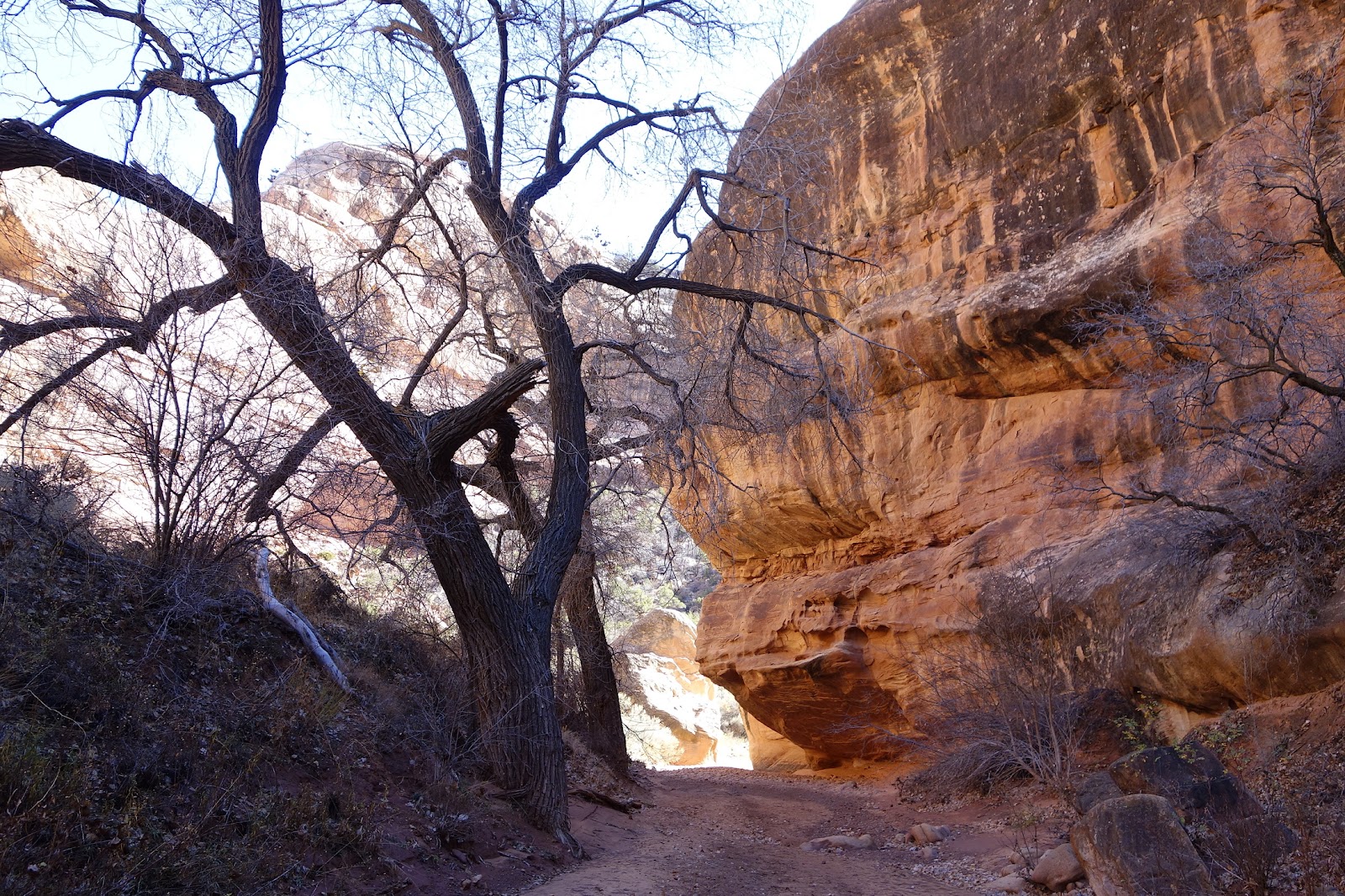
The hike downstream is just as delightful as upstream, but feels very different. The canyon narrows and tall cliffs tower on either side. Huge house-sized boulders lie strewn about as though casually tossed there by giants. The creek itself meanders through all this, minding its own business, almost lost among all this drama. It's gorgeous!

Close below our campsite, in the damp sand by the creek, we came upon the tracks of a large cat. They seemed large for bobcat—we figured mountain lion. They were quite fresh, no more than a few hours old, and they followed the stream down and then back just as we did, so as we hiked down we'd see the tracks appear, then disappear, then appear again a little further on. There were times when I found myself wondering whether we were being watched.

The cliffs to either side fell away and Nankoweap Canyon opened up to a wide plain as we approached the confluence with the Colorado. Nankoweap Creek suddenly looked puny compared to the broad river winding its way lazily in front of us. We took a fork of the trail that climbed steeply up the cliffs to the right, heading toward the Nankoweap Granaries.
As we worked our way up the narrow trail, the perspective on the landscape changed and we found ourselves looking down the Colorado as it wound its way between the vertical red cliffs on either side. To say that the view was mind-bogglingly stunning is a huge understatement.
The trail to the granaries is steep and narrow and loose-rocky, and also very rewarding: first for the views, then for the granaries themselves: now just walled-in "rooms", but amazing when you pause to think of the people who made them, in this precarious place, some nine hundred years ago. (Also, it's in shade in the middle of the day, which is a huge plus when the sun is hot overhead.)
 |
| Nankoweap granaries |

|

|
| Hanging out near the granaries |
Tom and Herman (can you spot them?) |

|
| The confluence of Nankoweap Creek and the Colorado |
We wandered around near the granaries for a while, then came back down and wandered around the river for a little bit. The scenery was gorgeous and the temperature perfect, and I could have stayed there for a long time.
We were almost back at our campsite when we ran into a lone hiker hurrying downstream. He turned out to be a Dutch photographer trying to photograph the Nankoweap granaries at sunset. The man was hiking alone, hadn't been here before (he was going off a GPS track someone had given him), and had managed to lose the trail several times already on the way down. He had underestimated the hike, he said, and at times had feared for his life. He asked if he could camp near us that evening and hike out with us the next day. His fear was sobering: until then, even though Nankoweap had been a challenging trail, I had never thought of it in terms of life and death.

|

|
| Approaching sunset |
Day 5

We broke camp early and began the hike out. The Dutch photographer hiked with us, reassured by the company even though we were moving slower than he was accustomed to. Eventually, once we were far enough up and the trail seemed pretty obvious, he said goodbye and hurried on ahead. He had a flight to catch and needed to be out. We took our time going up the trail. The hike was hard but uneventful: the views were just as gorgeous as on the way down, the trail just as breathtaking (maybe a bit more so because of the extra water we were carrying for the dry camp above Tilted Mesa and the next day's hike).
We reached our campsite mid-afternoon. The sun was strong and hot in a cloudless sky, so—as on the way down—we took shelter in the shade of the junipers and dipped into our remaining drambuie.
The afternoon wound down quickly, the cliffs and canyons below us changing color and texture almost as we watched. Dinner was early: so-so rehydrated food, but what views!
One of the joys of camping in the Grand canyon is the brilliant show of stars after dark. We had timed this hike for around a new moon, which made the show all the more vivid. I slept without a tent this last night, and so had a skyful of stars as my ceiling. And every time I woke up at night, I'd open my eyes and see this brilliant field of stars. Eventually the sky began to pale to the east—at first almost imperceptibly, then little by little a bit brighter—and the stars slipped away and vanished one by one.
Day 6
The last day of the hike. We had about eight miles to the trailhead, but most of the steep stuff was behind us so it wouldn't be too bad.
We were on the trail a little after sunrise. The red sandstone cliffs of the Supai were spectacular in the golden light of the early morning. We took our time, with plenty of scenery breaks and a nice long lunch break at Marion Point, and finally climbed over the Canyon rim in the early afternoon.

|

|
| Supai cliffs in the early morning light |
Saddle Mountain |
I've always found the tail end of the hike out of Nankoweap—the walk from the rim back to the trailhead—to be mentally challenging. You've just done a long hard hike and are ready to be done with it—and climbing out from below the rim feels like that ought to be it!—except there are still three more miles to go. And while most of that is an easy downhill, right towards the end there are a couple of small steep hills that are taxing simply because you're mentally done climbing steep hills. Of course, you do it, because there's no other choice, but it's an effort just the same. Then, before you know it, there's the sign at the trailhead and the hike is done.
I'm looking forward to my next hike down Nankoweap already.


 We reached our campsite mid-afternoon. The sun was strong and hot in a cloudless sky, so—as on the way down—we took shelter in the shade of the junipers and dipped into our remaining drambuie.
 The afternoon wound down quickly, the cliffs and canyons below us changing color and texture almost as we watched. Dinner was early: so-so rehydrated food, but what views!


 Close below our campsite, in the damp sand by the creek, we came upon the tracks of a large cat. They seemed large for bobcat—we figured mountain lion. They were quite fresh, no more than a few hours old, and they followed the stream down and then back just as we did, so as we hiked down we'd see the tracks appear, then disappear, then appear again a little further on. There were times when I found myself wondering whether we were being watched.
 The cliffs to either side fell away and Nankoweap Canyon opened up to a wide plain as we approached the confluence with the Colorado. Nankoweap Creek suddenly looked puny compared to the broad river winding its way lazily in front of us. We took a fork of the trail that climbed steeply up the cliffs to the right, heading toward the Nankoweap Granaries.


 We broke camp early and began the hike out. The Dutch photographer hiked with us, reassured by the company even though we were moving slower than he was accustomed to. Eventually, once we were far enough up and the trail seemed pretty obvious, he said goodbye and hurried on ahead. He had a flight to catch and needed to be out. We took our time going up the trail. The hike was hard but uneventful: the views were just as gorgeous as on the way down, the trail just as breathtaking (maybe a bit more so because of the extra water we were carrying for the dry camp above Tilted Mesa and the next day's hike).